It is tempting to think of the American Revolution as a war between the American colonists on one side and the British on the other. This was not the case. Many colonists did not want independence from England. These people, called loyalists, supported the king. Some loyalists fought against their neighbors, called patriots, who wanted independence. North Carolina’s Native American population also had to decide whether to support the Revolution.
The nearly two hundred years before the Revolution saw the loss of a huge number of North Carolina’s Native population. Although we do not know for sure, most experts agree that in 1600 the Indian population was at least ten times greater than it was in 1775. That means in less than two hundred years, the Indian population had lost nine out of ten people.
War caused some of this population loss. Among the bloodiest was the war fought by the Tuscarora Indians from 1711 to 1712. An even worse enemy was disease. The Indians had no natural immunity to many European diseases, including measles and typhus. The deadliest killer, however, was smallpox. Time after time this dread illness destroyed entire Indian villages. An epidemic of smallpox killed thousands of Cherokees in 1738 and 1739. In 1759, smallpox killed about two-thirds of the Catawbas, leaving about 500 of that tribe’s population of 1,500.
By the time of the Revolution, very few Indians were left in eastern North Carolina. However, many Cherokees and other Indians still lived in the western part of the state. The Indians were important trading partners for the colonists. They traded furs and animal skins for the colonists’ cloth and such manufactured goods as guns, ammunition, axes, and agricultural tools. Gradually the Indians became dependent on this trade. Guns were especially important. Indians needed guns to defend themselves against other armed tribes. This trade created problems. As the Indians expanded their hunting grounds to find more deer for the colonists, the more likely they were to trespass on settlers’ farms or to bump into other tribes. And this would lead to conflicts.
The difficulties between the colonists and the government in England seemed to threaten the colonists’ trade. They wondered what they should do. Should they stay neutral? Was it even possible to stay neutral? Should they side with the British, who promised them weapons? Or should they side with the patriots, who promised them weapons but also kept taking their ancestral lands?
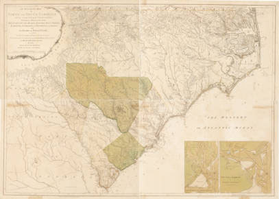
This powerful tribe lived in the mountains of present-day North Carolina, Georgia, and Tennessee. They spoke the language of the Iroquois Indian nation but were so spread out that they spoke three separate dialects. In 1775, there were about 12,000 Cherokees in North Carolina. They lived in villages called Middle Villages or Middle Towns, and grew crops, especially corn. Some lived in log cabins similar to white settlers’ cabins. They had lived in these mountains a long time and regarded the mountains as their home forever, and they were determined to fight to protect their lands.
As the settlers pushed west into the backcountry, they came closer to the Cherokee homeland. In the late 1750s and early 1760s, the English fought the French and Indian War against the French colonies to the north and west. At first, the Cherokees supported the British colonists in that war. But after some of their warriors were killed by settlers in Virginia, the Cherokees changed their minds. The tribe then fought several battles against the English settlers in North Carolina. The English defeated the Indians and their French allies in that war.
In 1763, King George III prohibited white settlement across the Appalachian Mountains to the west. But settlers, among them Daniel Boone, violated this law. They wanted the Cherokees’ land. Most of them thought the Indians were simply an obstacle to be brushed aside. The Cherokees hated the settlers, so they decided to side with the British government. They thought this was their best chance to push back the tide of white settlers. They felt that if the British won the war, the British king would reward their support and stop settlers from going to the other side of the mountains and taking their land.
This decision for war was not made hastily. Many meetings were held and every warrior had a chance to speak his mind. Other Indian tribes who were allied with the British tried to talk the Cherokees into joining their efforts. The British wanted their Indian allies to wait and together attack the settlers at the same time. Finally, the Cherokees decided they would not wait for the British or anyone else and would launch their own attack.
Early in the summer of 1776, the Cherokees planned attacks all along the southern frontier. A half-Indian woman named Nancy Ward warned the settlers of the plan. Many settlers found refuge at Fort Dobbs, Old Fort, Fort Defiance, and other safe places. When they returned, they found their homes burned and their crops destroyed. Not all were so lucky. About forty settlers had been killed in North Carolina by the end of July. The biggest fight was at Eaton’s Station, in present-day Tennessee. Here a young Cherokee warrior named Dragging Canoe led a war party against a group of frontiersmen in a bloody attempt to stop whites from settling on Cherokee land.
The colonists reacted swiftly. Most agreed with Thomas Jefferson who wrote, “I hope that the Cherokees will now be driven beyond the Mississippi.” The settlers planned a massive attack. One group of militia would enter Cherokee country from North Carolina. Another would enter from South Carolina. Still a third would enter from Virginia. These three armies would combine and make a massive assault on the Indians.
General Griffith Rutherford led more than 2,000 North Carolina troops into the mountains. They reached the Cherokee Middle Towns in the middle of September but found the villages deserted. The Indians had retreated to strongholds or villages deeper in the mountains. Rutherford burned their villages and destroyed their food supplies and crops waiting to be harvested.
The almost 2,000 South Carolina troops were commanded by Colonel Andrew Williamson. They came into North Carolina from the southeast and walked into ambush at a place called Black Hole, near present-day Franklin. After a two-hour battle, the Cherokees fell back. The Indians might have won the battle if they had not run out of ammunition. Colonel Williamson’s troops continued their advance and joined forces with Rutherford’s troops on September 23. The combined army continued their destruction, meeting only scattered resistance.
Rutherford and Williamson took their troops home in early October. About the same time, another group of North Carolinians and Virginians commanded by Colonel Williams Christian, came into the mountains. They burned more villages. Many Cherokees went hungry that year.
The majority of Cherokees returned home in the autumn of 1776 and began rebuilding their villages. They desperately needed a peace treaty. One elder, named the Raven, traveled hundreds of miles seeking peace. Another group went all the way to Williamsburg, Virginia, to meet with Virginia officials. The Cherokees signed a peace treaty in July 1777. By this treaty, the Cherokees gave up more of their land and agreed to return hostages and property. In exchange the settlers agreed to respect the Cherokees’ property rights.
The treaty should have ended hostilities, but it did not. Many settlers broke the treaty. One group of young Cherokee warriors refused to accept the peace treaty. They were led by Dragging Canoe. These warriors moved farther into the interior of North Carolina, not far from present-day Chattanooga, Tennessee. They built a group of villages that became known as the Chickamaugas. Dragging Canoe and his followers maintained their allegiance to the British even after the peace treaty was signed. Fighting continued throughout the war. An expedition in 1780, under the command of John Sevier and Arthur Campbell, burned a large Cherokee village and some of the Chickamauga villages. Twenty-nine Cherokees were killed in this expedition, but only one patriot. Afterwards, the Raven told a British official, “The Rebels from Virginia attacked… in such numbers last fall there was no withstanding them, they dyed their hands in the Blood of many of our Women and Children, burnt 17 towns, destroyed all our provisions by which we and our families were almost destroyed by famine this spring.”
The war was devastating for the Cherokees. They lost warriors, property, and influence. Most important, they continued to lose their land to settlers. In the 1777 treaty talks, a Cherokee named Toqua told the settlers: “We are now talking together. The Man above has put it into our hearts to do so this day. But brothers, do you remember that the difference is about our land.” He was right. The difference was about their land. Well into the 1800s, the Cherokees surrendered land in treaty after solemn treaty, only to see settlers ignore those treaties. In the 1830s, most of the tribe had been removed to Oklahoma, many dying during the trek called the “Trail of Tears.” A few Cherokees remained in the east. Many of their descendents continue to live in the North Carolina mountains.
The Cherokees and the Catawba Indians were enemies. The Catawbas had fought beside the British during the French and Indian War, while the Cherokees had turned against the British.
When Colonel Williamson invaded the Cherokee homeland in 1776, he had twenty Indian scouts with him. At first, the Cherokees thought the scouts were their own tribesmen; then they noticed that the Indians were wearing deer tails in their hair. They realized that the scouts were Catawbas, and the deer tails were identification so the Americans would recognize their Catawba allies.
Catawbas lived in the Carolina Piedmont. They were not related to the Cherokee. They spoke a completely different language called Siouan. Their name survives today in Catawba County and the Catawba River. The Catawba usually got along well with their white neighbors. They were important trading partners. However, they suffered from the same diseases that ravaged other tribes. They survived as a tribe only by taking in other smaller tribes which had also lost many of their people.
Like the Cherokees, the Catawbas faced great pressure to surrender their ancestral homes to land-hungry settlers. As the tribe got smaller, this pressure increased. Shortly before the Revolution, a reservation was established for the Catawba in South Carolina just below the North Carolina border. This reservation was near what is now Rock Hill, South Carolina. It was fifteen square miles in size. Most Catawbas lived on the reservation, although small groups continued to live in North Carolina. The Catawbas hoped that having their own reservation would protect them from land-hungry settlers. The reservation also brought money into the tribe because they rented part of the land to white farmers. The Catawbas felt that they were better off supporting the colonists who had helped establish their reservation. The Catawbas feared the British might not protect their right to the reservation. Throughout the war, the Indians helped the revolutionaries by returning runaway slaves, tracking down loyalists, and serving as scouts.
The Catawbas suffered for this decision. The British controlled the area around their reservation for much of 1780 and early 1781. The Catawbas fled when the British troops approached. The troops commanded by Lieutenant Colonel Francis Rawdon, burned the Catawba village and any Catawba homes they could find. When they returned, the Indians found that “all was gone; cattle, hogs, fowls, etc., all gone.” Still, the Catawbas continued to fight against the British. They fought in several battles in North Carolina, among them at Guilford Courthouse. Many Catawbas served under South Carolina General Thomas Sumter. The Catawbas usually fought as a unit under the command of a white officer. However, one company of forty-one men was commanded by a tribesman named Thomas Drennan. This group served with General Sumter. A Catawba known as New River led a unit of Indians fighting in North Carolinian William Davie’s army. Another Catawba hero, John Nettles, had been educated at the College of William and Mary in Williamsburg, Virginia, and was a major in the militia.
The Catawbas earned the gratitude of Carolinians for their support during the Revolution. This gratitude helped them hold onto their reservation. After the war they continued to live there, and some of their descendents live today on the reservation.
The Catawbas remembered the war. One Indian, Peter Harris, had captured a gun at the Battle of Stono and proudly carried the gun with him for the rest of his life. Another Catawba, whose name we do not know, saved Captain Robert Craighead’s life at the Battle of Hanging Rock. Each year he would appear at Craighead’s plantation so that he could be thanked once again by the soldier.
The Indians in North Carolina fought beside their chosen white allies in the American Revolution. But they fought for their own reasons. They were not concerned about the rights of free-born Englishmen. They were interested in protecting their own lands. The Cherokees and the Catawbas made their decisions for war based on their best judgment of how they could protect their lands. The Catawbas backed the winning side and gained some benefits. Whatever the reasons, these two important Indian tribes were active participants. It was their war, too.
Image Credits:
“Indian Brave. Eastern Cherokees, Near Asheville, N.C.” Photograph. Ca. 1915-1930. https://dc.lib.unc.edu/cdm/singleitem/collection/nc_post/id/1847 (accessed July 11, 2018).
"An Accurate Map of North and South Carolina With Their Indian Frontiers, Shewing in a distinct manner all the Mountains, Rivers, Swamps, Marshes, Bays, Creeks, Harbours, Sandbanks and Soundings on the Coasts, with The Roads and Indian Paths; as well as The Boundary or Provincial Lines, The Several Townships and other divisions of the Land in Both the Provinces; the whole from Actual Surveys by Henry Mouzon and Others." Map. Originally published by Robert Sayer and John Bennett in The American Atlas (London). 1775. https://dc.lib.unc.edu/cdm/ref/collection/ncmaps/id/9632 (accessed July 11, 2018).